Brazil's northernmost point is closer to Canada than to Brazil's southern border
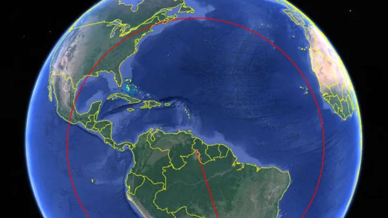
The northernmost point of Brazil, Monte Caburaí in the state of Roraima near the border with Guyana, lies at approximately 5°16′ north latitude. Brazil's southernmost point, Arroio Chuí in Rio Grande do Sul on the border with Uruguay, is located at about 33°45′ south latitude, according to the Brazilian Institute of Geography and Statistics (IBGE).
The northernmost point of Brazil, Monte Caburaí in the state of Roraima near the border with Guyana, lies at approximately 5°16′ north latitude. Brazil's southernmost point, Arroio Chuí in Rio Grande do Sul on the border with Uruguay, is located at about 33°45′ south latitude, according to the Brazilian Institute of Geography and Statistics (IBGE).
The straight-line distance from Monte Caburaí to the southern border is roughly 4,390 kilometres (2,730 miles). By comparison, the distance from Monte Caburaí to Canada's southern mainland border is approximately 4,300 kilometres, making Canada's closest point slightly nearer than Brazil's own southern extremity.
The counterintuitive result stems from the curvature of the Earth rather than the familiar flat world maps. Because the globe narrows toward the poles, travelling north across the Caribbean and eastern North America reaches southern Canada in fewer kilometres than travelling south through the full length of Brazil.
The finding also reflects Brazil's enormous north-south span. Covering 8.5 million square kilometres, Brazil is the world's fifth-largest country by land area and stretches across more than 39 degrees of latitude, according to IBGE and the CIA World Factbook.
RECOMMENDED FOR YOU
From Suomi to Zhongguo, why some countries have completely different names at home
Many people mistakenly believe Brazil's northernmost point lies at the Amazon River or near the Equator. In fact, Monte Caburaí sits north of the Equator, meaning part of Brazil lies in the Northern Hemisphere. The Equator crosses the states of Amazonas, Pará, Amapá and Roraima, placing about 7% of Brazil's territory north of the line.
Brazil's geographic dimensions have produced several other unusual distinctions. The country borders every South American nation except Chile and Ecuador, has the world's longest continuous tropical coastline at nearly 7,500 kilometres, and spans four time zones.
Geographers say such comparisons illustrate why great-circle distances—the shortest routes over the Earth's curved surface—often differ from impressions created by two-dimensional maps. They are the same principles used by airlines when plotting transcontinental flights that appear to curve over the Arctic but are actually the shortest paths between destinations.
This story is written and edited by the Global South World team, you can contact us here.