How much of each country is in Europe?
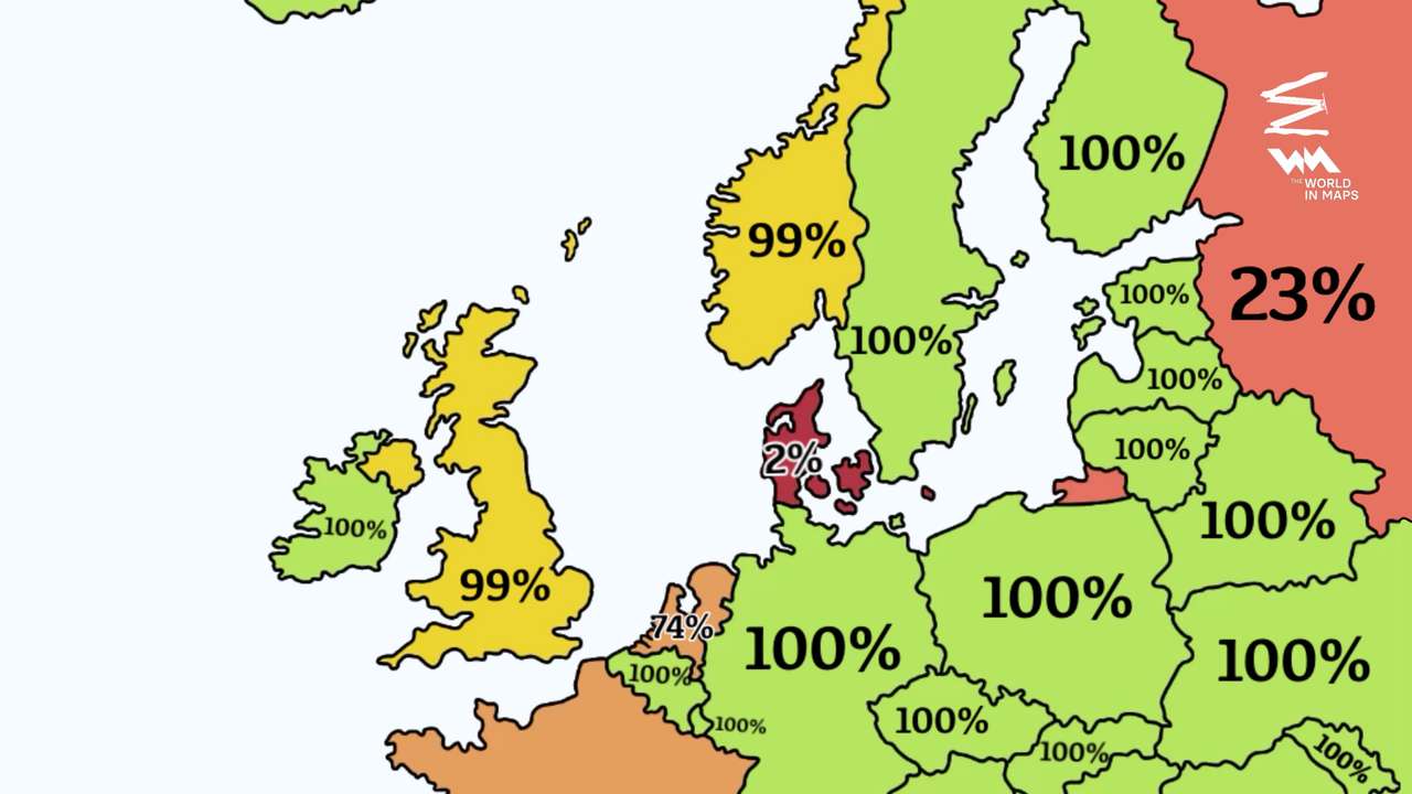
Most European countries lie entirely within the continent, but several extend beyond its geographical boundaries, highlighting how geography, history and politics shape the definition of Europe.
Key points
- Most European countries lie entirely within the continent.
- Russia has roughly 23% of its territory in Europe.
- Overseas territories reduce the European land share of several countries.
Most European countries lie entirely within the continent, but several extend beyond its geographical boundaries, highlighting how geography, history and politics shape the definition of Europe.
France, the United Kingdom and the Netherlands are shown with smaller European shares because they have territories outside mainland Europe. The map estimates that 81% of France and 74% of the Netherlands lie within Europe, although those figures depend on how overseas territories are counted.
Russia stands out as the largest country spanning Europe and Asia. The map places just 23% of its territory in Europe, with the remaining landmass extending across northern Asia.
Despite occupying a smaller portion of Russia's territory, European Russia contains most of the country's population, including Moscow and St. Petersburg.
RECOMMENDED FOR YOU

‘Victory is within reach’ - Ahmad Tibi vows to bring down Netanyahu's government
Denmark is another unusual case. The map assigns just 2% of its territory to Europe, apparently counting Greenland, the vast Arctic island that forms part of the Kingdom of Denmark.
The geographical boundary between Europe and Asia is generally drawn along the Ural Mountains, the Ural River, the Caspian Sea region and the Caucasus, although some sections remain disputed.
Countries such as Turkey, Georgia and Azerbaijan illustrate why continental classifications can be complicated. Their geographical positions and political ties do not always fit neatly into a single continental category.
The map also highlights the difference between geographical territory and political identity. Countries can be closely associated with Europe while holding substantial territory elsewhere.